| Home | About Us | Email Us | Find It | What's New | Back | Next | |
| VIEWER MESSAGES | ||
|
| MISCELLANEOUS | ||||
|
||||
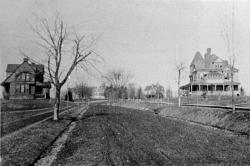 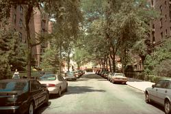 Pictures dated c. 1890 and 2002
Click images to enlarge |
The First Streets
Before 1900, there were few streets in North Richmond Hill. Those that existed were dirt roads, lit by oil lamps, and almost impassible in winter. The sidewalks were made of cinders and in the winter time, narrow plank walks were laid down which were then taken up in the spring. The circa 1890 picture is of one of those streets - Church Street, first known as Market Street, today known as 118th Street. You are looking half a block away.
Sources:
References:
- Kew Gardens Country Club, Inc. Booklet, p. 8 (1929)